Journal by Charles Amsler, Ph.D.
Posted on 10/30/2001 at 3:30 p.m.
Greetings from the Drake Passage between the southern tip of South America and the northern tip of the Antarctic Peninsula.
We left from Punta Arenas, Chile, a day late because we needed to rendezvous with the RVIB Nathaniel B. Palmer, the National Science Foundation's other Antarctic research vessel (RVIB means Research Vessel Ice Breaker). The NBP, as it is referred to, had several scientists aboard who needed to go to Palmer Station. They had been on another cruise that was delayed in heavy sea ice so we waited a day to take them and a fair bit of science equipment needed at Palmer Station on board.
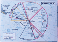
In the next few hours we'll cross 60 degrees south latitude, which is the "official" boundary of the Southern Ocean and of all things that can legally or technically be called "Antarctica." But oceanographically and biologically, the Southern Ocean and Antarctica really start at something called the Antarctic Polar Frontal Zone. An older name for that is the Antarctic Convergence, and that is still what most people refer to it as informally. That is where the cold surface waters of the Southern Ocean sink beneath the warmer surface waters of the South Atlantic Ocean (and South Indian and South Pacific), and its exact location varies over time.
Although this cruise to Palmer Station is primarily a shuttle taking scientists, equipment, and supplies to the station, there is also a little bit of science going on. One of the main activities is part of a long-term project to map the changes in the boundary of the Antarctic Polar Frontal Zone and a couple other oceanographic features of the area. Because the different water masses have different temperatures (in this case, the colder Southern Ocean and warmer northern waters) and different temperature-depth profiles, measuring the temperature of the water at different depths help you map these oceanographic features. The device we are using for these measurements is an expendable bathythermograph, which is called a XBT for short. "Expendable" refers to the fact that it can only be used once and is lost in the process. "Bathy" refers to the ocean's depths and "thermograph" is a fancy way to say thermometer. So it is a ocean thermometer that can be used only once.
They are actually small torpedo-shaped objects about a foot or so long. Attached to them are 800 meters of very thin copper wire that is in turn attached to a recording device on the ship. When the XBT is released it falls into the water and sinks very rapidly. It continuously sends temperature readings back to the recorder on board through the thin wire that spools out behind it.
When it gets to 800 meters depth (and almost all of the measurements we are doing are in 800 m or greater water depths) the wire breaks and the temperature data end. But that's fine since for these purposes — only the upper few hundred meters of temperature data are necessary. All of us who are helping with this take four hour shifts each day. We load a launcher on the fantail (back end) of the ship that holds six of the XBTs. Today the seas were so rough that the fantail was awash with waves. That made it too dangerous for all but the most experienced of the crew to go out and load the launcher, so the rest of us had to let them do it for us. Each time they did, the bridge crew turned the ship around so that the fantail was protected from the waves while the other crew members went out to load the XBT launcher.
The individual XBTs are encased in blue plastic cylinders so you can't really see the torpedo-like part. They are launched by a computer on board at specific coordinates (latitude and longitude) that are preprogrammed and the same for lots of different ship cruises. Recently, those have been about every 40 minutes around the clock. Our job is to monitor the launch and make sure that nothing goes wrong. Sometimes a wire breaks too soon or the ship rolls just the wrong way during the launch, and when that happens we need to manually order the computer to launch another XBT right away to get the data. We can tell whether or not everything went OK because the temperature data from each depth are being graphed on the computer monitor as the XBT goes down. There is also a TV camera trained on the launcher and we can watch it launch on a monitor that is right above the computer station.
It is fun watching the temperature-depth profile being generated and comparing that to the ones from before. From that we know that although we aren't quite to the 60 degrees south legal boundary of Antarctica we are already south of the Antarctic Polar Frontal Zone and, therefore, oceanographically we are in Antarctica.
So, greetings from Antarctica!
Expedition Journal Entries by Charles Amsler, Ph.D.:
Taking the Ocean's Temperature
Posted on 10/30/2001 at 3:30 p.m.
Getting There by Air and by Sea
Posted on 10/20/2001 at 11:30 a.m.
Getting Ready
Posted on 10/19/2001 at 8:00 a.m.
|