I felt like a cuckoo clock the night before we reached Palmer Station. As I slept in the top bunk of my cabin, seemingly on the hour I woke and sat up wondering if we were there yet. Peering out the porthole conveniently located at mattress level by my knees I could see our ship, the Laurence M. Gould (LMG) was still a ways offshore to go yet. Back to sleep.
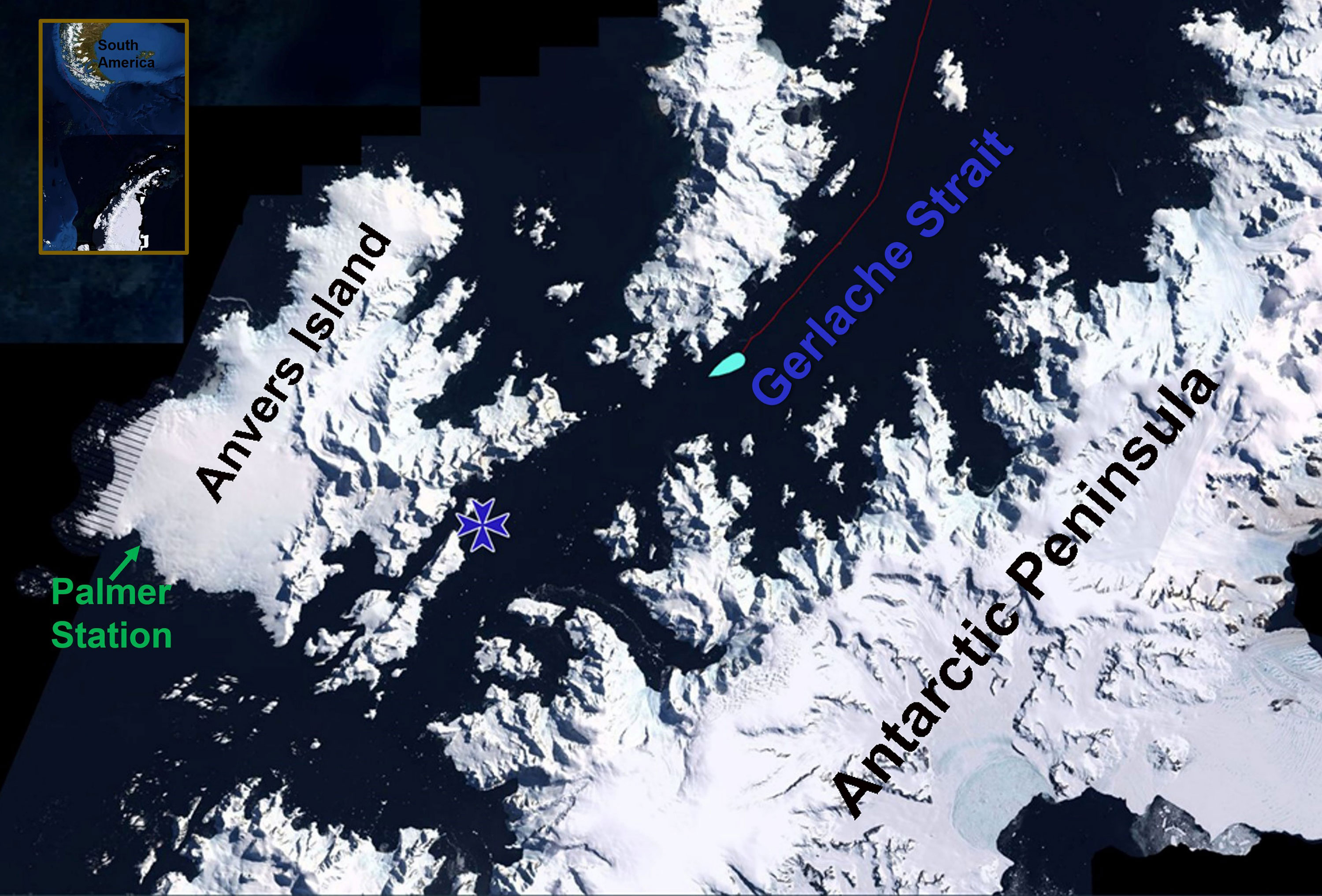
Many onboard, me included, wanted to be up on deck a few hours prior to arriving at Palmer Station to view the home stretch which included sailing through a very scenic passage. I gave in at 4AM, dressed and trekked up to the bridge with its array of monitors, including one showing the ship’s cruise track, an annotated version is shown above. The bluish teardrop is the LMG and we were indeed hours from Palmer. We were cruising down the wide Gerlache Strait with the mountainous, glaciated Antarctic Peninsula off to port and snowy hummocks and peaks of Brabant Island to starboard. Breathtaking grandeur even under gray skies and low clouds.
The blue star on the opening image denotes the entrance to one of the most scenic passages along the Peninsula – the Neumayer Channel which courses between Wienke Islands and Anvers Island. The entrance and upper section are often choked with ice forcing Palmer-bound ships to continue south via the Gerlache. The passage was ice-free allowing us transit between the spectacular steeply rising cliffs. About halfway through the passage, the channel appears to dead end. As you can see on the image above, the route takes a very sharp turn toward Anvers Is. after which the channel widens before the ship later takes right turn for the home stretch to Palmer. It never fails to amaze me just how intrepid the early explorers of this area (during the Belgian Antarctic Expedition 1890s) were, navigating these waters in sailing ships and without the aid of technology like radar to show the way!
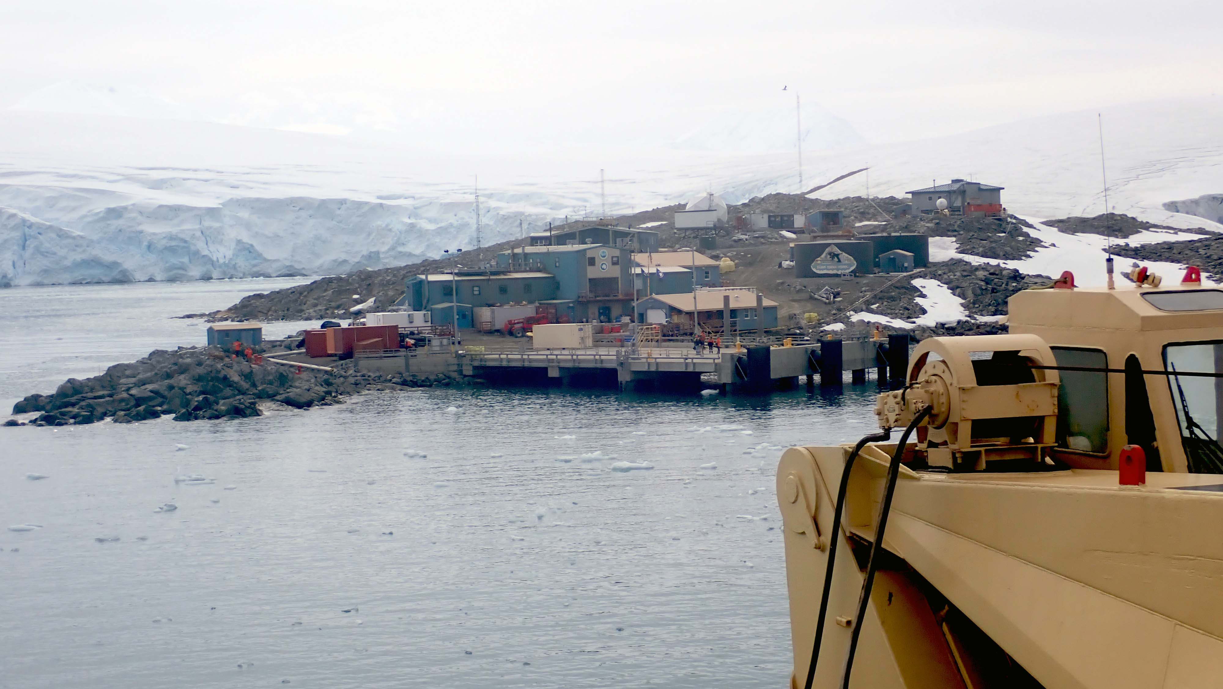
The morning sky remained overcast, but spirits onboard were anything gray. Everyone was excited to reach this long awaited destination and get to work doing science. One final turn, around the small rocky peninsula of Bonaparte Point had Palmer Station dead ahead off the bow. So much looked the same since my last view of station in April 2020, but several changes stunned me. More about those in another post. There will also be prettier images of the station to come in future posts, but I suspect for most onboard this view of terra firma and, for Team UAB our southern home, was a sight beautiful to behold.
The next two days were a blur of activity as Team UAB in A moved off ship and on station, sat through numerous orientations, single filed around on station tours, dragged personal gear to our dorm rooms and started unpacking our science gear. The LMG cast off with most the scientists we sailed with from Chile – their mission a five week science cruise in waters to the south. A calmer atmosphere settled on station as we forty-one adjusted to new routines and new faces.
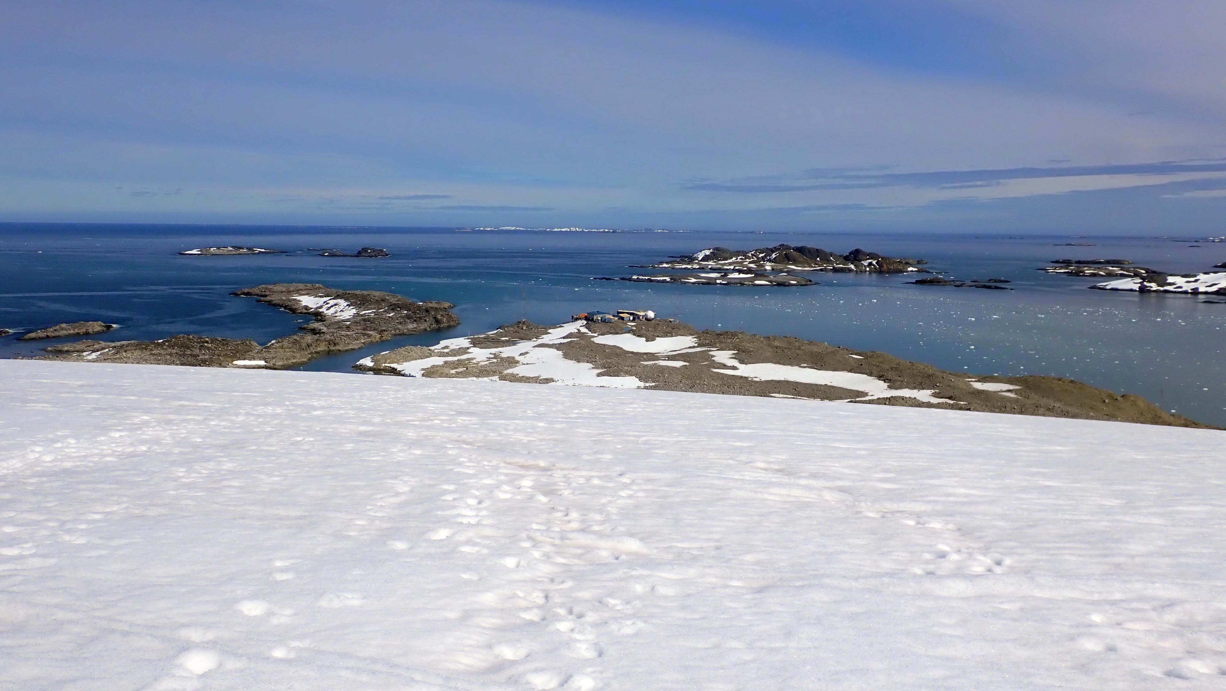
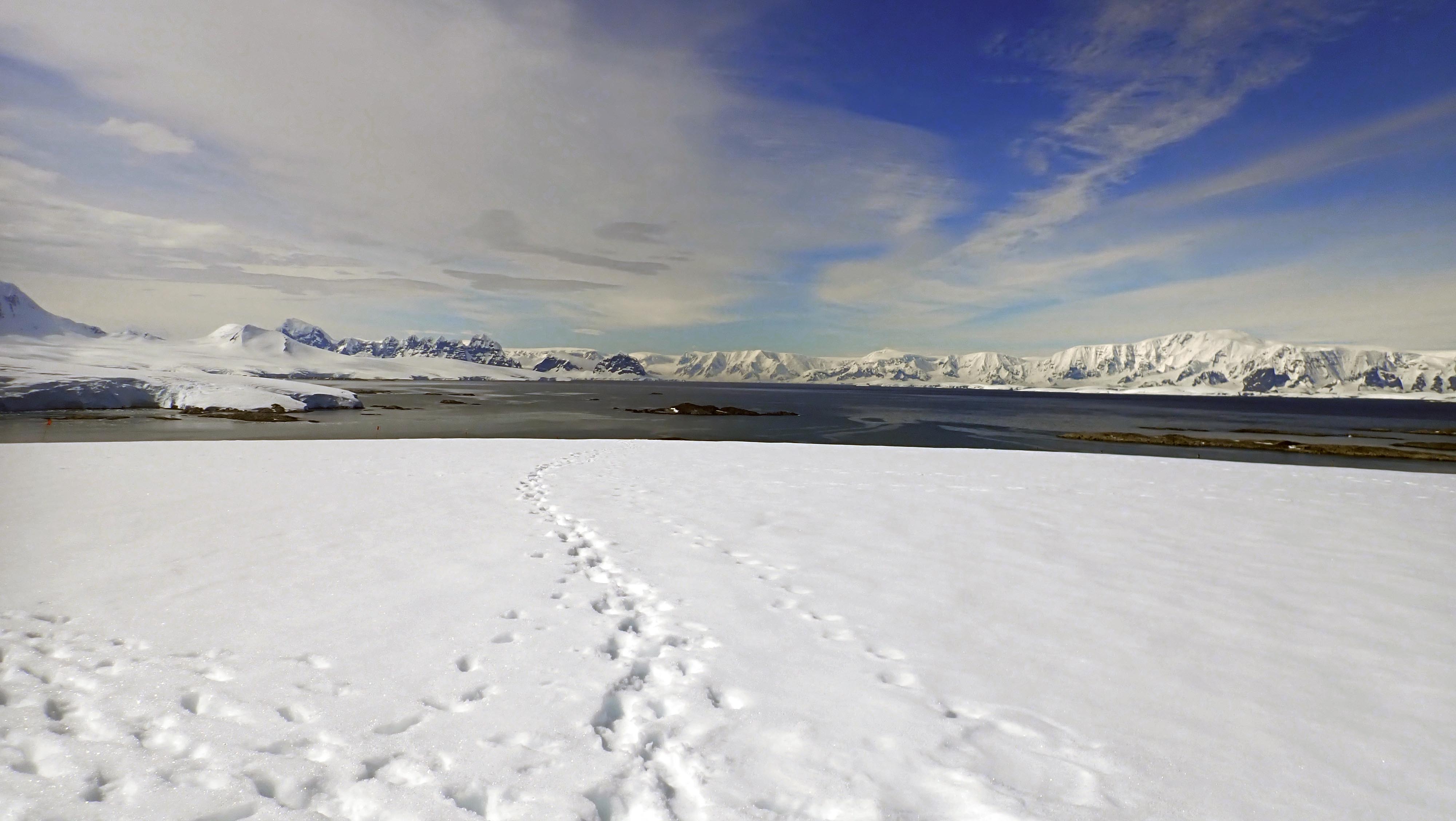
Palmer Station at maximum population is 44 about half of which are scientists the other half support- like the cooks, electrician, power plant mechanic, doctor, etc. The support folks work six days a week with Sunday being a day off. Team UAB follows suit with Sunday morning as our “day” off. Mother Nature favored us all our first Sunday by being calm, clear and sunny. I took advantage of my free time to hike up the glacier that rises behind station. The walk through Palmer’s rocky, bouldered ‘backyard’ has gotten much longer over the years (more about that in a future post too) but the views of Palmer and vicinity from part way up the glacier are marvelous as reflected in the image above. The rocky peninsula left of center is Bonaparte Point. The small assemblage of buildings comprising Palmer Station look so insignificant in the midst of mostly snow free, nearby islands. The nearest island just across the waters of Arthur Harbor and a tad right of center is Torgersen Island, home to the now active PenguinCam
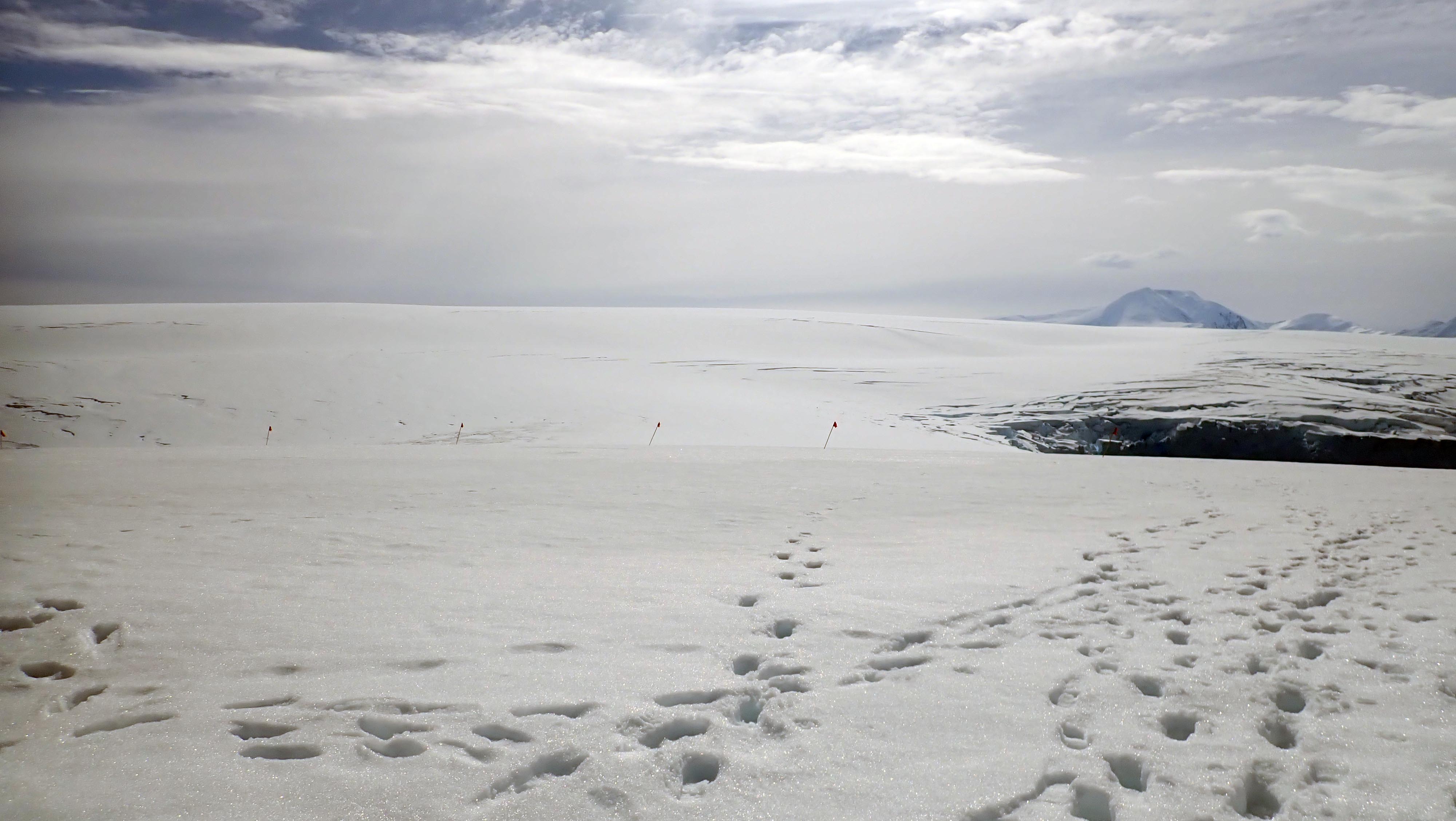
Continuing up the glacier, the slope flattens once the wide plateau of this polar piedmont is reached. Beneath my feet and before my eyes is the expanse of the Marr Glacier. The many deep boot prints in the snow proof that I was not the first to visit the plateau. The flags mark the end of the safe, crevasse-free zone. Far beyond that flagline is Mount Francais, at 9500 ft elevation it is the highest peak on Anvers Island.
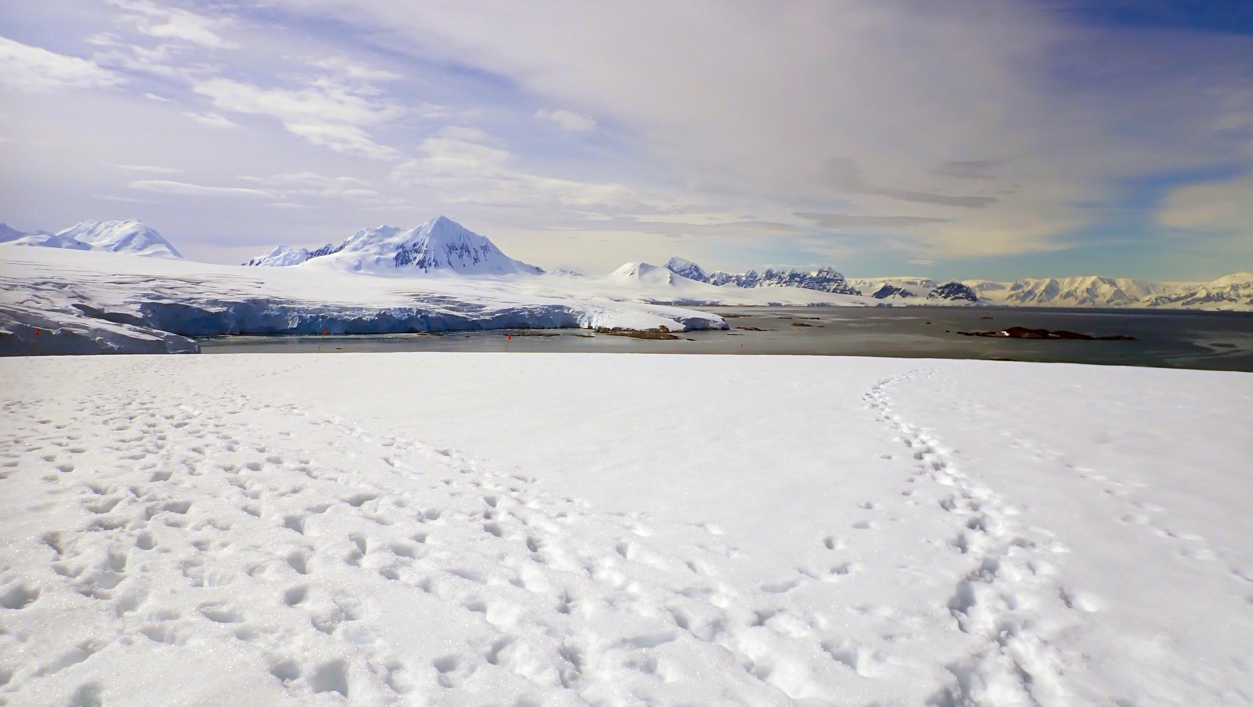
Panning to the southeast, Francais is now the far left peak in the image above and to the right is the commanding, majestic Mount William rising to 5200’. It looks higher than Mount Francais in the photo because it is many miles closer to Palmer. Looking to the right of Mt. William, on the southeast horizon are the dark, steep cliffs of the Wall Range on Wienke Island. The LMG motored by those cliffs in the Neumayer, the towering cliffs stretching 4000 feet into gray sky the day we arrived. The snowier mountains further to the right are ranges on the Antarctic Peninsula. Landmarks include Humphries Heights (2000 ft), Mounts Shackleton (4800 ft), Scott (2900 ft) and Peary (6200 ft), all of which have been summited during various climbing campaigns.
On descent from my little climbing campaign, I drank in the northerly views of Arthur Harbor, nearby islands and more of Anvers Island. Nice spot to settle in and do science for the next few months. I hope this little tour has given you a better idea of where we have gone!