 Gabriela Oates, Ph.D., director of UAB’s institutional Social Determinants of Health Core, is leading a project funded by an HSF-GEF grant to improve care by combining patient records with their residential information. The goal: “to improve patient care and people’s health.”Patients are treated at the hospital, but their histories happen elsewhere — mostly at home.
With a new grant from the UAB Health Services Foundation General Endowment Fund, Gabriela Oates, Ph.D., director of the Social Determinants of Health Core in the Minority Health and Health Equity Research Center, is leading a project to combine patient records with their residential information.
What does your address have to do with your health? Several years ago, Oates and Ariann Nassel, director of Geospatial Data Visualization at UAB’s Lister Hill Center for Health Policy, did a pilot study to answer that question as it relates to lung health. Using historical addresses since 2010, converted into location points by Nassel, the researchers selected each patient’s address at the date closest to their diagnosis with lung disease. They overlaid this information with maps of air quality, walkability, food access, segregation and other neighborhood characteristics, which can vary significantly across the Birmingham metro area. “We wanted to see if those exposures, in combination with patient data, could predict lung function over time,” Oates said. They did.
That is just one example of the power of geographic information systems, or GIS. These software tools can bring data into the three-dimensional world in which actual people live, allowing researchers to analyze location-based measures such as Census data and more. Ultimately “these tools can be used to improve patient care,” Oates said.
How do I access ArcGIS Pro?
If you already know what products you want to access, email Ariann Nassel at
In August 2023, the Social Determinants of Health Core was selected to join UAB’s Institutional Core Research Center program. Although GIS work is just one element of the SDOH Core offerings, “it is a critical part,” Oates said. And it is growing. In spring 2023, the Center for Clinical and Translational Science funded campuswide access to the leading GIS technology Esri GIS. “Now any UAB researcher, faculty or staff member, or student can get access to ArcGIS Pro and other Esri GIS products,” Nassel said. Nassel created the Geospatial Research and Information Domain, which collects the university’s GIS resources and connects practitioners.
For the past several years, Oates and her group have been working on developing risk-stratification tools for COPD and lung health. (Oates is director of Population Health Sciences at the UAB Lung Health Center.) For certain conditions, doctors regularly use data such as body-mass index, waist ratio, comorbidities, age and sex to “determine the frequency with which patients are followed and the treatment plans for those patients,” Oates said. “We are showing that, if you add to those factors other social and environmental factors — where a person lives or works, air quality, food access, green space — you can improve risk prediction.”
Generally in research, these factors are assessed one at a time; “but they don’t exist in isolation,” Oates said. “We have created a joint index of multiple social and environmental exposures. The next step is to incorporate it in clinical care.” Oates and her team will work toward that goal with their HSF-GEF grant.
Applications window opens May 1 for 2024 HSF-GEF Awards
This site will be open May 1 through 4 p.m. June 28 for applications.
Another aim of the grant is to screen individual patients for unmet needs, including housing, transportation and food. Geographical information such as patient addresses, transformed into geographical coordinates and merged with census-tract data, can drive assessments in the emergency department. “If we can screen for those unmet needs, we can identify risks and link patients to available resources,” Oates said. This work is interlinked with the UAB Learning Health System Platform project led by Michael Mugavero, M.D., professor in the Division of Infectious Diseases, which received an HSF-GEF grant in 2021. (Learn more about Mugavero's project here.)
Several other researchers and research groups have similar interests, Oates points out, and “we all need to screen patients in the same way.” Her HSF-GEF grant will pilot efforts to put everyone on the same page. Documenting this work consistently in the electronic health record is another point of emphasis. In a pilot project, Oates and her team identified up to 18 codes being used related to housing alone, and many other duplicated codes among some 40,000 clinical events. They systematically organized them into a subset of 20, including food, housing, clothing, water and transportation. “The next step is to use the same screening tool,” Oates said. “There are a lot of people involved.”
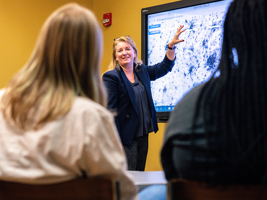 Ariann Nassel is director of Geospatial Data Visualization at UAB’s Lister Hill Center for Health Policy. Her job is to translate addresses into geographic locations that can be merged with Census data to identify exactly which county, census tract or block group patients live in. Nassel’s job is to translate addresses into geographic locations that can be merged with Census data to identify exactly which county, census tract or block group patients live in. This is an ongoing process. “People move, and new patients come in who have not been geocoded,” Nassel said. “Then extend this out five to 10 years, and even if a patient hasn’t moved, the environment has changed. You can’t do this one time; you have to keep doing it.” To complicate matters further, exposure indices change often; the area deprivation index that Oates’ group commonly uses is updated roughly every two years.
Oates and team have developed guidelines to help researchers. “You can’t use current addresses to study why people got cancer 20 years ago; that is bad science,” Oates said. “We explain that you need to measure the exposures before you measure the outcomes, and help investigators find the appropriate data to do that.”
“It is the right time” to expand GIS capabilities at UAB, Nassel said. “We are encouraging more researchers to use it and realize its utility.” The School of Public Health has faculty focused on climate change and health who have interest in tracking mold growth and water quality with increased temperatures and humidity, for instance. Another example: Alabama’s abundant timberland requires a significant number of planned fires to prevent wildfires. That can have an effect on lung health, including asthma exacerbations, where rural areas and new developments abut undeveloped land.
“You can’t use current addresses to study why people got cancer 20 years ago; that is bad science,” Oates said. “We explain that you need to measure the exposures before you measure the outcomes, and help investigators find the appropriate data to do that.”
Nassel is also working with investigator Ryan Coute, D.O., assistant professor in the Department of Emergency Medicine, who is studying the location of out-of-hospital cardiac arrests and the likelihood of the patients’ receiving CPR. “We are performing hotspot analyses to pinpoint areas with increased out-of-hospital cardiac arrests and where bystander CPR is occurring,” Nassel said.
The same types of spatial statistics are also used to study crime data. “In both cases, you want to look at where something occurs in relation to other events,” Nassel said. “Are they randomly located, or are they clustered together? And if they are clustered, why? Spatial statistics look at whether a hotspot is statistically significant based on population density. And where something is not occurring can be just as interesting as where it is occurring.”
The goal of this exciting work, Oates emphasized, “is using these tools to improve patient care and people’s health.”
How do the HSF-GEF awards advance UAB? Faculty explain their projects:
How the HSF’s General Endowment Fund awards help UAB compete on a national stage
Advancing faculty careers through the UAB Academy of Health Professions Educators
Building immuno-imaging at UAB through specialized technology
Turning a pilot project into the standard of care
Making the leap from one hospital to another through UAB’s STEP Program
Building a health system that can learn calls for “team science to the max”
Using geographic information systems in patient-oriented research